
Mapping entire cities,
in minutes instead of weeks.
Transparency: Equip Sport is where our founders work. This tool was built by us end to end, and the numbers below come from real usage.
$0.60 a pin, one at a time.
Every time Equip expanded into a new city, the same slow process kicked off. An outsourced agency received a 17-page operational guide and began crawling Google Maps, Street View, and satellite imagery to inventory every park, sports court, and green space in the city, one pin at a time.
Each location was catalogued in a spreadsheet: sport type, public or private, accessibility, coordinates, zip code, number of courts. Then the filtering started. Remove private clubs. Remove irrelevant sports. Copy the survivors to a new Excel sheet. Import it as a layer on MyMaps. Research the city's best neighbourhoods and crime hotspots via Google and ChatGPT. Draw a polygon for the proposed impact zone. Filter by zip code. Then review each remaining pin individually on satellite imagery: is the park too small? Full of trees? A memorial garden? Delete it from both the spreadsheet and the map.
The deliverables were a multi-sheet Excel file, a layered MyMaps with half a dozen hand-built layers, and an optional PowerPoint summarising the methodology. The agency charged roughly $0.60 per pin. A mid-size city with 800+ locations to scan meant hundreds of dollars and days of manual work, per city. And every new city started the whole process from scratch.
The same pipeline, automated.
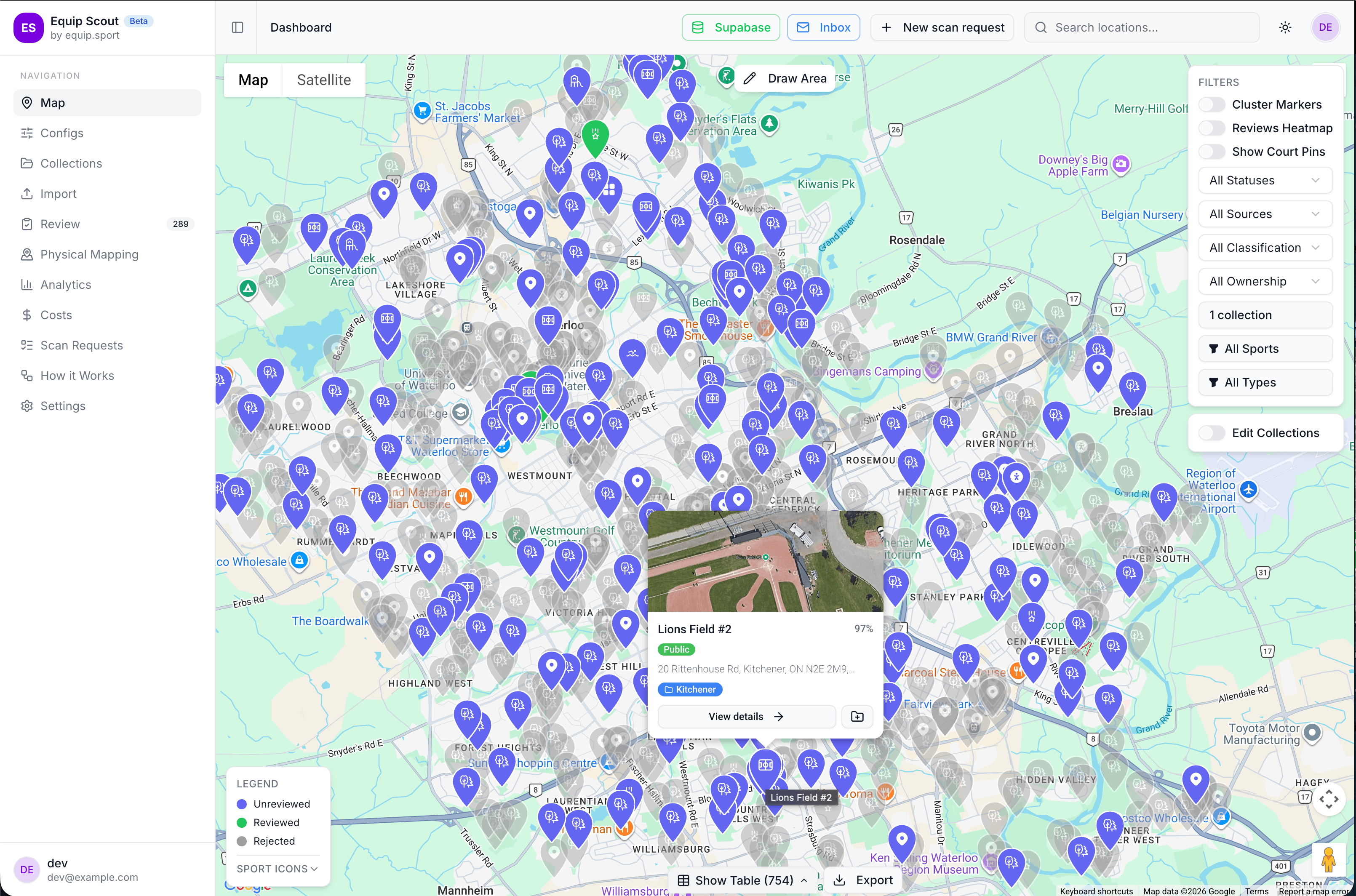
Equip Scout replaces the entire outsourced mapping workflow with a single internal tool. Feed it a city and a set of constraints (target sports, maximum zone size, desired pin count) and it runs the same logical steps the agency did, in minutes instead of days.
The Scout pipeline runs in four steps. First, it auto-discovers every sports facility and park in the target city from multiple data sources. Second, AI classifies each location by sport type, public vs private access, and suitability for station deployment. Third, the system filters out private courts, irrelevant sports, and unsafe areas using city-specific criteria. Fourth, it proposes the optimal impact zone (balancing density, safety, and neighbourhood activity) with a ready map and data export.
Source. The tool pulls every sports facility, park, and public court in the target city from multiple data sources automatically. No manual Google Maps crawling.
Classify. AI analyses each location using available metadata to tag it: sport type, public vs. private, court count, size, and suitability for station deployment. The same judgement calls the agency made by eye (is this park big enough? is it covered in trees? is it a memorial garden?) now happen automatically.
Filter. The city-specific criteria that used to require manual Excel filtering and MyMaps layer gymnastics (priority sports, public-only, unsafe-area exclusion) are applied in a single pass.
Zone. Instead of researching neighbourhoods on Google and drawing a polygon by hand, Scout scores locations against density, neighbourhood activity, accessibility, and safety data to propose the optimal impact zone, complete with a ready map and data export.
From outsourced process, to internal edge.
What used to be a multi-day, multi-deliverable outsourced engagement now runs in minutes. A new city that would have cost hundreds of dollars in per-pin agency fees costs roughly $20 in compute and API calls. The 17-page operational guide the agency needed? Encoded in the tool itself.
More importantly, quality became consistent. The old process depended on whoever happened to be doing the mapping that week: their judgement on which parks were "too small," their Google searches for crime data, their hand-drawn polygons. Scout applies the same criteria every time, city after city.
The tool shipped in three weeks and is now the default way Equip prepares every new city deployment.
Want one of these?
Tell us where you're starting from and we'll point you at the right way in: a deep-dive build, a focused feature, or a quick production-readiness pass.